
Rain alert for Chennai, Puducherry: IMD flags heavy showers, schools shut
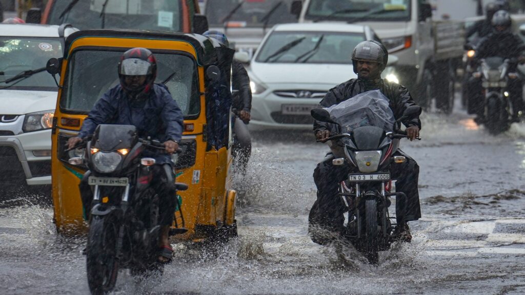
Chennai – Tamil Nadu entered a wet spell this week as the India Meteorological Department (IMD) issued fresh rain alerts for Chennai and Puducherry. The city began the week under cloudy skies, and the IMD said intermittent light showers may continue through Friday. Maximum temperatures may settle around 31 to 32°C, while moderate rain or thunderstorms could appear at short intervals.
However, conditions may shift again toward the weekend. The IMD issued a thunderstorm and lightning alert for Saturday. The agency said Chennai may see partly cloudy skies, followed by sudden rain, brief thunderstorms, or dust storms. The overall pattern indicates unstable weather returning after a relatively calm midweek.
Chennai also recorded warmer nights. Minimum temperatures rose 1.6°C to 3°C above normal. This trend extended across several districts, including Coimbatore, Dharmapuri, Salem, Thirupattur, and Tiruvallur. Erode and Madurai airports logged the highest daytime temperature at 32°C, while Karur Paramathi dipped to 20°C—the lowest minimum in the plains.
Meanwhile, heavy rain disrupted normal life in Puducherry and Karaikal. Continuous downpour since Saturday led to waterlogging on major roads and in residential areas. As a result, authorities declared a holiday for all schools and colleges on Monday. Home and Education Minister A. Namassivayam said both government and private institutions would remain closed due to the ongoing rainfall.
Further south, the IMD predicted heavy rain in several Tamil Nadu districts. Kanyakumari, Tirunelveli, Tenkasi, Thoothukudi, Ramanathapuram, Virudhunagar, Pudukkottai, Thanjavur, Tiruvarur, Nagapattinam, and Mayiladuthurai may see intense showers. Karaikal may also receive heavy rain as part of this pattern.
Multiple weather systems are driving this wet phase. A low-pressure area near the South Andaman Sea strengthened on Monday. The IMD said it may intensify into a depression and later form a cyclonic storm as it moves west-northwest. This system is pulling moisture toward Tamil Nadu, creating cloudy skies and rain.
At the same time, another circulation near the Comorin region may form a fresh low-pressure area around November 25. This second system will add more moisture to southern districts. A third system over the Southeast Arabian Sea is also influencing the broader weather pattern.
Together, these systems are shaping a complex and unsettled phase for Tamil Nadu. Southern districts may face stronger rain bands, while Chennai will likely see light to moderate rain with bursts of thunderstorms. The IMD continues to monitor shifting conditions as the state prepares for more wet weather in the days ahead.