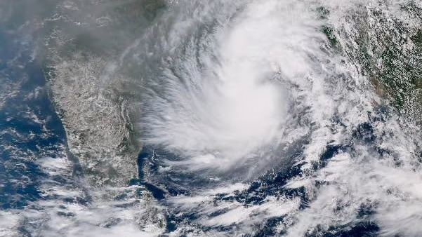
Cyclone Dana may recurve after landfall: IMD

The India Meteorological Department (IMD) announced Thursday that Cyclone Dana has intensified and may shift slightly after landfall. The storm is expected to hit between Bhitarkanika and Dhamra in Odisha late Thursday night or early Friday morning. However, officials warn that its path could change after landfall.
Regional Meteorological Director Manorma Mohanty reported that the cyclone is now located 210 km southeast of Paradip, 290 km south-southeast of Dhamra, and 350 km south-southeast of Sagar Island. Moving northwest at 15 km per hour, the storm has been on a north-northwest course over the last six hours. Although the current trajectory is steady, the cyclone might veer slightly west-southwest.
Wind speeds in Balasore, Bhadrak, and Kendrapara are expected to reach 100 to 120 km per hour during landfall. High tides, uprooted trees, damaged power lines, and destroyed thatched homes are also likely. Heavy rain is forecasted over the next two days in several areas.
In response, a red alert has been issued for Mayurbhanj, Kendrapara, Balasore, Bhadrak, Jajpur, and Cuttack districts, where heavy rainfall is expected in the next 24 hours. Additionally, an orange alert is in effect for Puri, Khurda, Nayagarh, Dhenkanal, and Keonjhar districts. A yellow alert has been issued for Sundargarh, Deogarh, Angul, Boudh, Kandhamal, Ganjam, Jharsuguda, and Sambalpur districts.
These precautions highlight the potential for severe impacts from the cyclone. Authorities continue to monitor the storm’s movements and urge people in vulnerable areas to stay alert.


